For Sale
All items are available for sale at Sawyer House (676 Main St, Bolton MA) during hours of operation.
If you are interested in any items and can't make it to Sawyer House please email boltonhistsoc@gmail.com about shipping possibilities
If you are interested in any items and can't make it to Sawyer House please email boltonhistsoc@gmail.com about shipping possibilities
Books
About Bolton...$37.00
by Esther Kimmons Whitcomb. The definitive history of the Town of Bolton, Massachusetts.
Heritage Books, 1988
by Esther Kimmons Whitcomb. The definitive history of the Town of Bolton, Massachusetts.
Heritage Books, 1988
Bolton Soldiers and Sailors in the American Revolution....$19.00
by Esther K. Whitcomb and Dorothy O. Mayo. Biographical sketches of all the Revolutionary War soldiers of Bolton, MA, including the present Town of Berlin which was the South Parish of Bolton until 1784.
Heritage Books, Inc., 1985
by Esther K. Whitcomb and Dorothy O. Mayo. Biographical sketches of all the Revolutionary War soldiers of Bolton, MA, including the present Town of Berlin which was the South Parish of Bolton until 1784.
Heritage Books, Inc., 1985
Bolton's Share in the American Revolution...$19.00
by Dorothy O. Mayo.
by Dorothy O. Mayo.
Towns of the Nashaway Plantation...$14.00
The Journal of Mary Elizabeth Haynes...$12.00
The journal of Mary Elizabeth Haynes of Bolton, MA chronicles her service as a volunteer nurse for the Union Army during the Civil War. The journal dates from October 10, 1864 to February 21, 1872.
Transcribed by the Bolton Historical Society.
The journal of Mary Elizabeth Haynes of Bolton, MA chronicles her service as a volunteer nurse for the Union Army during the Civil War. The journal dates from October 10, 1864 to February 21, 1872.
Transcribed by the Bolton Historical Society.
Maps
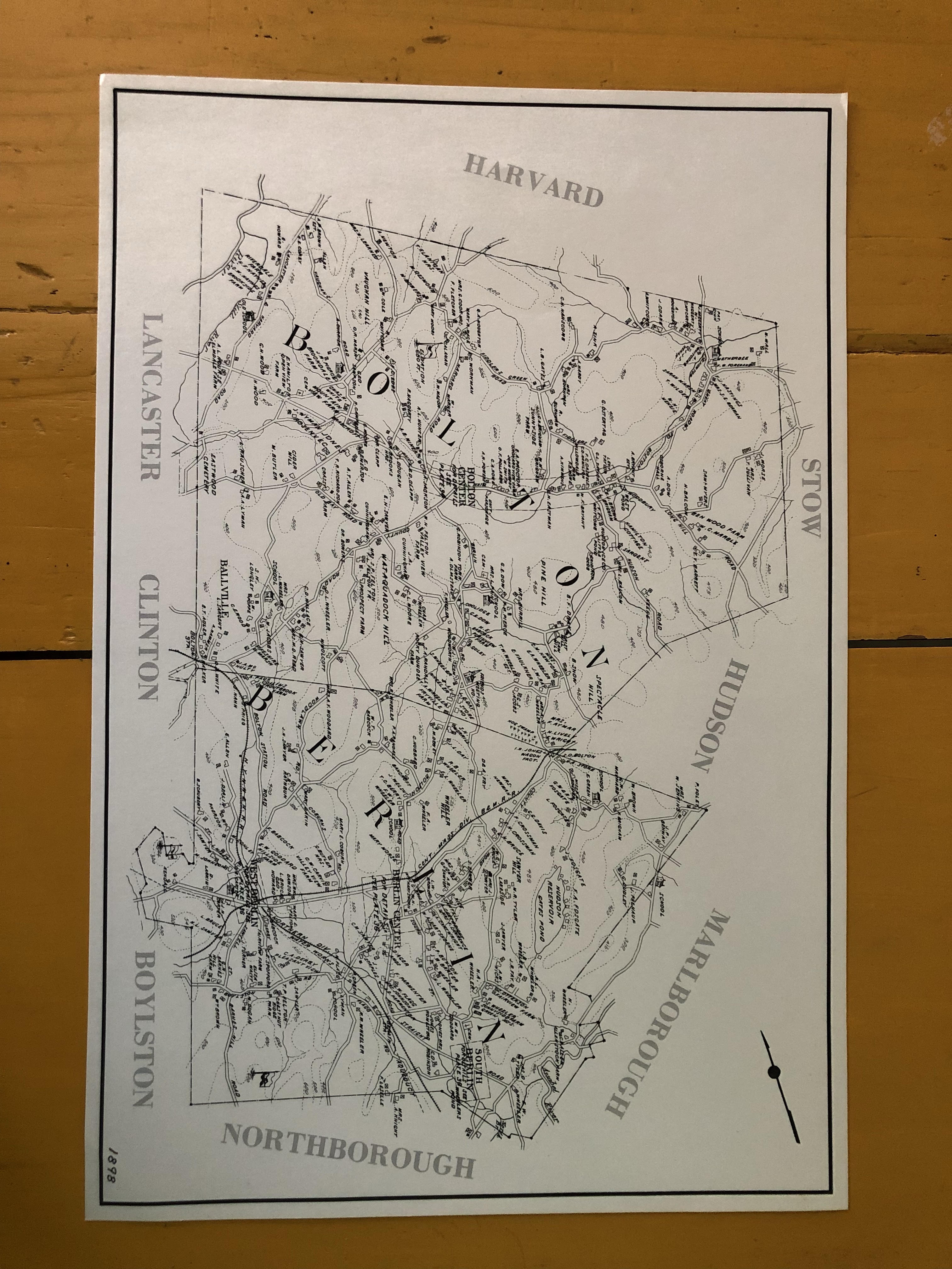
1898 Bolton/Berlin Map...$7.00
This map is from a Worcester County Atlas, and was also sold on a subscription basis. The level of detail is extraordinary, showing homes, barns (marked with an x), prominent estates, and charming renditions of schoolhouses and churches.
Dimensions: 12" x 18"
This map is from a Worcester County Atlas, and was also sold on a subscription basis. The level of detail is extraordinary, showing homes, barns (marked with an x), prominent estates, and charming renditions of schoolhouses and churches.
Dimensions: 12" x 18"
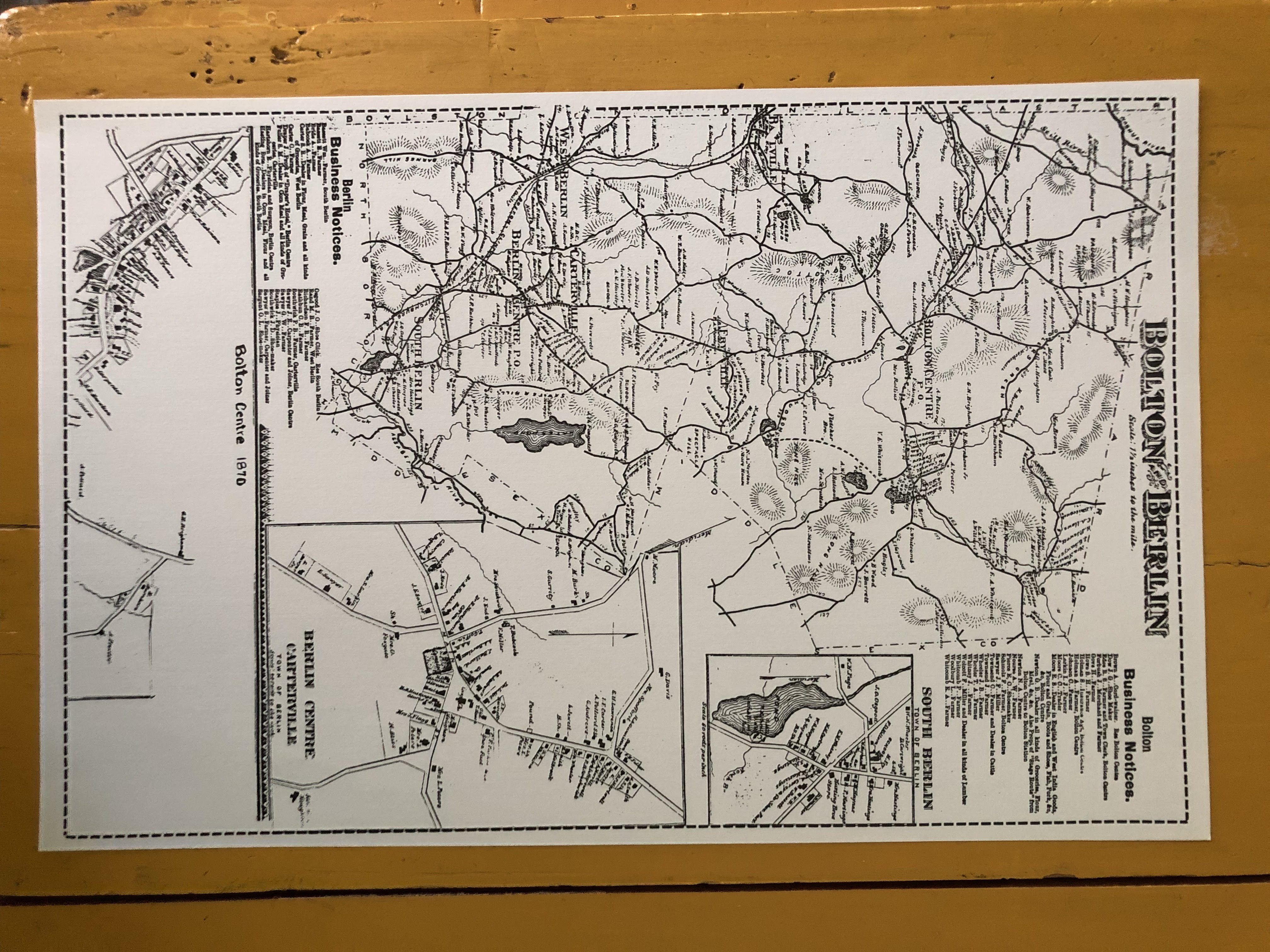
1898 Bolton Center Map Insert...$7.00
Details the town center from the 1898 Bolton/Berlin Map. Dimensions: 11" x 17"
Details the town center from the 1898 Bolton/Berlin Map. Dimensions: 11" x 17"
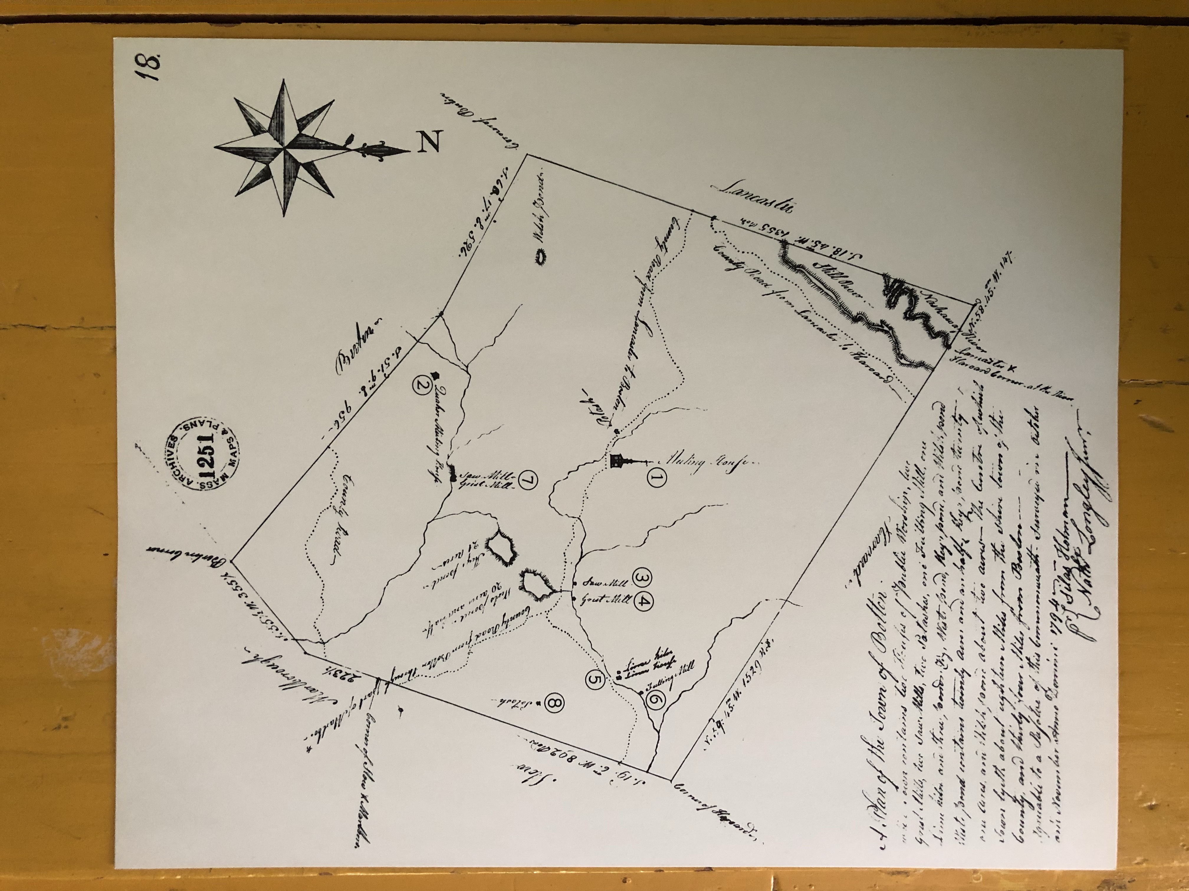
1794 Town Map...$7.00
In 1794 the town of Bolton created this map which shows border towns and the locations of the county roads, two meetinghouses (town and Quaker), several mills, two potash works, the lime kiln, ponds, and rivers. This the earliest known map of Bolton. Dimensions: 12 3/4" x 15"
In 1794 the town of Bolton created this map which shows border towns and the locations of the county roads, two meetinghouses (town and Quaker), several mills, two potash works, the lime kiln, ponds, and rivers. This the earliest known map of Bolton. Dimensions: 12 3/4" x 15"
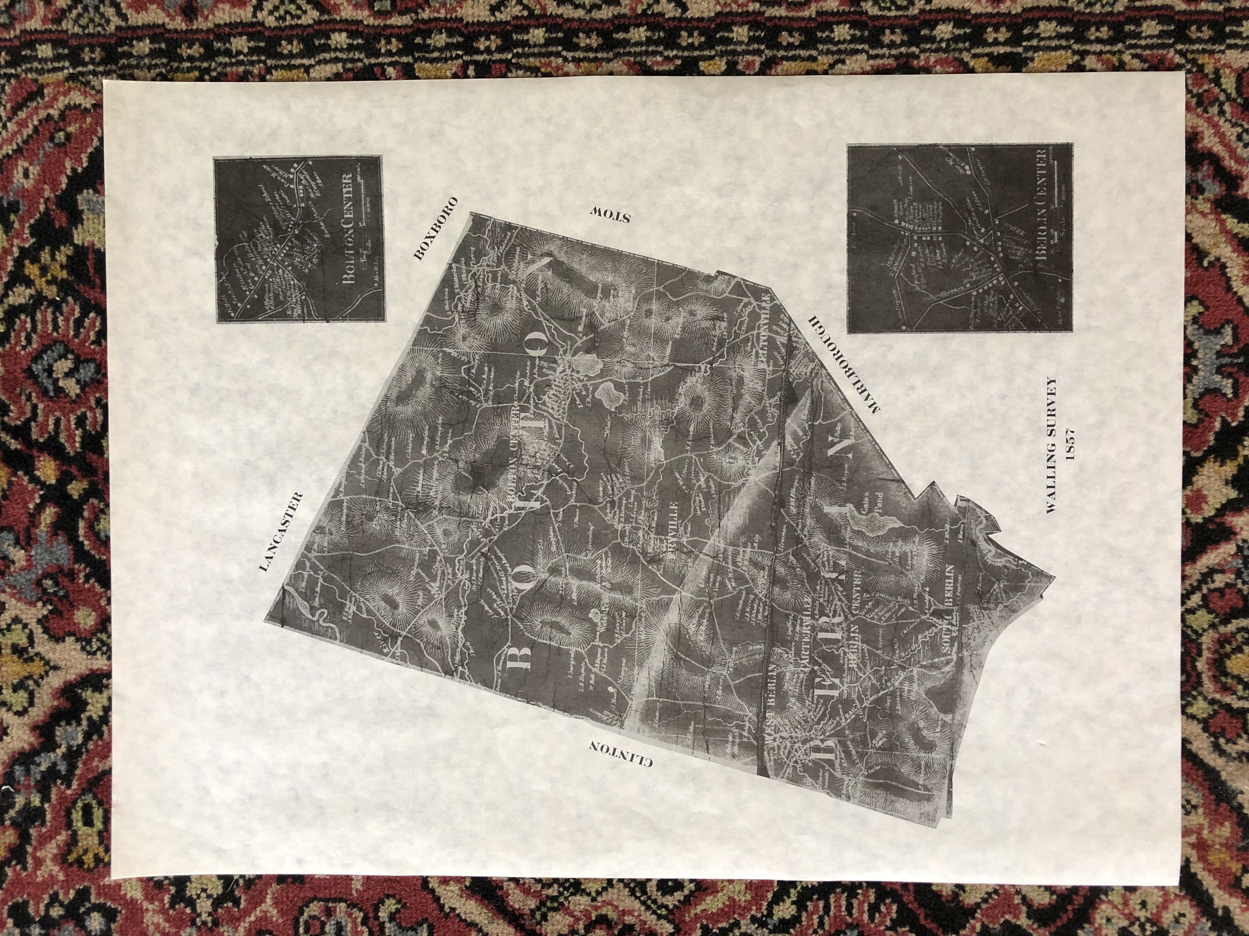
1857 Walling Survey Map...$7.00
Black on white map of Bolton made by "Superintendent of the State Map" Henry F. Walling in 1857. Dimensions: 18" x 24"
Black on white map of Bolton made by "Superintendent of the State Map" Henry F. Walling in 1857. Dimensions: 18" x 24"
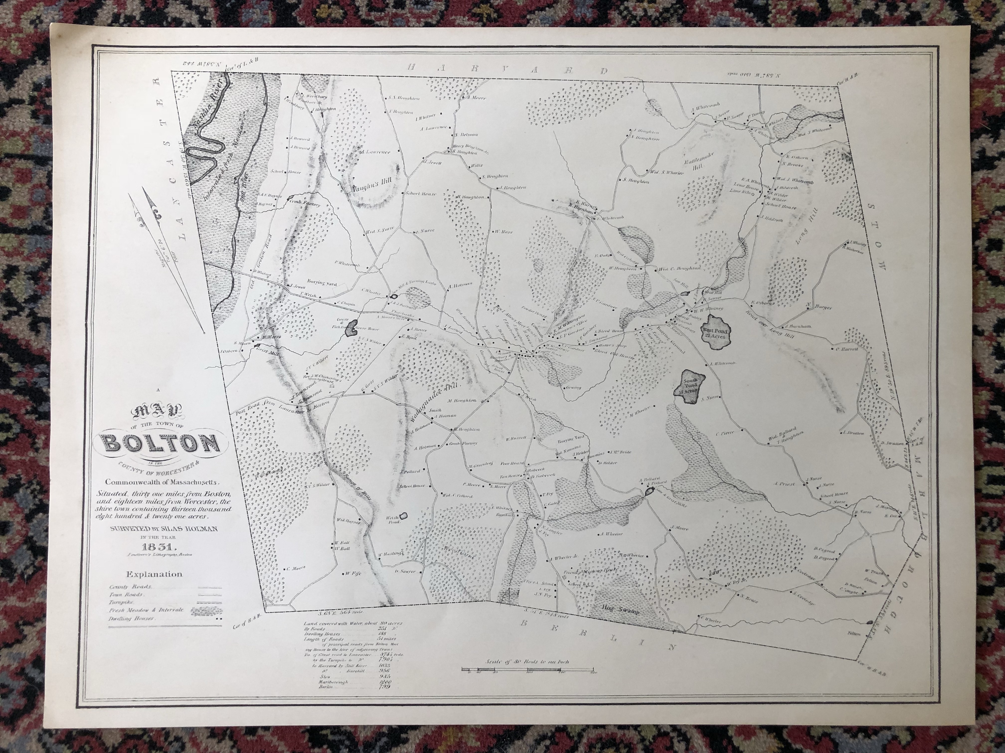
1831 Holman Map...$12.00
This is the lithograph version of Silas Holman’s 1831 map. It was printed by Pendleton’ Lithography, a lithographic print studio in Boston. Dimensions: 19" x 25"
This is the lithograph version of Silas Holman’s 1831 map. It was printed by Pendleton’ Lithography, a lithographic print studio in Boston. Dimensions: 19" x 25"